A trending technology in many different industries, geofencing isn’t really the barrier it sounds like—it’s more of a gateway or checkpoint that can provide valuable information. Here’s what you need to know about geofencing technology.
What is geofencing?
So, what does geofencing mean, and how do we define geofencing?
Geofencing definition: the use of GPS, RFID, WiFi, or cellular data to establish a digital geographic boundary.
A geofence is a virtual boundary that’s set around a geographic area. The technology is designed to track movement and send notifications when something hits the boundary or geofence location.
How does geofencing work?
Geofencing technology is set up a little differently for each use case, depending on the data being collected. However, each geofencing technology has a few basic features in common.
First, a virtual perimeter is defined through an application. Once the threshold of the virtual barrier has been crossed by a mobile device, an if/then command performs a predefined function.
This “e-perimeter” is generated and enforced using GPS, RFID, Wi-Fi, or cellular data. When an object enters or exits a geofence location, it triggers an action. The triggered action can vary, as well—it generally takes the form of an email or push notification. The “if this, then that” function can have several applications for geofencing, meaning that you can set your personal mobile device to control other smart technology. Exactly who is notified and why depends on the rules set up in the system.
Example: A fleet manager wants to be notified when company vehicles enter and exit company property between the hours of 10:00 pm and 5:00 am. Each vehicle has a device onboard that is tracked through GPS. The fleet manager leverages his fleet tracking application to set a perimeter around the company headquarters. He sets up a “trigger” so if a vehicle leaves the company premise between 10:00 pm and 5:00 am, then he receives an email notification.
The Lytx Fleet Tracking Service shows how much time a driver spent inside the geofence
Why do fleets use geofencing?
Geofencing is a feature offered in some GPS fleet tracking solutions that can provide insight into daily operations. Businesses use the technology to track and receive notifications when vehicles enter or exit specified areas. Why? Geofencing data can be critical to improving operations and productivity. More specifically, the information helps fleets:
- Understand how much time vehicles spend on highways, which can aid fleet fuel management and maintenance scheduling.
- Know where drivers are at all times to improve customer service, route optimizations, and general fleet management.
- Monitor when vehicles leave company premises, ensuring drivers are on schedule and there’s no unauthorized use of vehicles.
- Track delivery times in order to provide customers with quick, accurate status information.
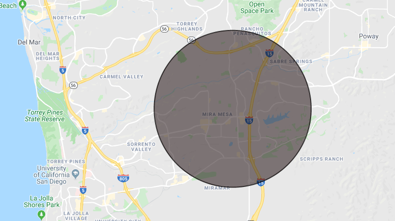
A geofence set up around a busy highway in California
How geofencing in the Lytx Fleet Tracking Service helps improve operational efficiency
Geofencing is a tool used by many fleets today. The Lytx Fleet Tracking Service allows fleet managers and dispatchers to instantly locate, track, and manage vehicles, with video support from the DriveCam Event Recorder. The geofencing feature itself is easy to use—you can create, edit, and view vehicle “time spent” in geofences in just a few steps through the Lytx interface.
The top benefits of geofencing with the Lytx Fleet Tracking Service include the ability to:
- Manage adherence to approved areas, and reduce unauthorized routes and hours.
- Get real-time notifications when drivers leave or arrive at specific locations, or use vehicles after hours.
- View reports of geofence violations on your mobile or desktop and export them in CSV format.
- Watch fleet dash cam footage that provides more context and insight about why a vehicle left a geofence.
Now that we’ve answered, “what does geofencing do?” you need to decide if it’s what your company needs.
See how your company can use geofencing technology to keep track of your vehicles. Schedule a demo to see the Lytx Fleet Tracking Service in action.